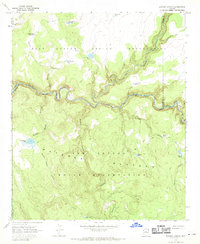
1967 Map of Elwood Canyon
USGS Topo · Published 1970About this map
The Black River carves a deep, winding path through the high desert of Graham County, serving as the primary boundary between the Fort Apache Indian Reservation to the north and the San Carlos Indian Reservation to the south. This remote high-country landscape is defined by the broad San Carlos Plateau and a series of rugged drainages like Elwood Canyon and Sawmill Canyon. Water management is the central human imprint on this territory, as evidenced by a network of cattle tanks and remote water sources including Mudhole Tank, Weaning Pen Tank, and the Elwood Windmill.
Find a feature on this map
30 named features on this map. Tap any name to fly to it.
Don’t see what you’re looking for? This feature index may not catch every label — zoom into the map to look around manually.
Map Details
Editions of this 1967 Elwood Canyon Map
This is the sole edition of this map. No revisions or reprints were ever made.
Other maps of this area

1954 · Clifton
USGS Topo · 1:250,000

1954 · Mesa
USGS Topo · 1:250,000

1957 · Mesa
USGS Topo · 1:250,000

1957 · Clifton
USGS Topo · 1:250,000

1958 · Clifton
USGS Topo · 1:250,000

1958 · Mesa
USGS Topo · 1:250,000

1960 · Mesa
USGS Topo · 1:250,000

1962 · Clifton
USGS Topo · 1:250,000

1964 · Mesa
USGS Topo · 1:250,000

1966 · Georges Butte
USGS Topo · 1:24,000