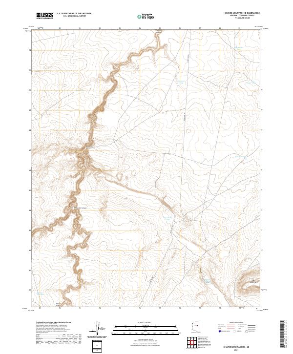
2021 Map of Chavez Mountain NE
USGS Topo · Published 2021About this map
Canyon Diablo cuts a deep and winding path through this corner of the Coconino plateau, a landscape defined by the survival of water in a high-desert environment. The distribution of livestock infrastructure, such as West Walker Tank, Limestone Tank, and Broken Dam Tank, indicates the area's continued reliance on grazing and range management. Along the western edge, the complex topography of Grapevine Canyon and Dog Valley provides a stark contrast to the flatter stretches to the east, while West Sunset Mtn anchors the southeastern corner as a prominent local landmark. The singular presence of Chavez Pass Rd serves as the primary corridor through these township lines, connecting the scattered water sources and isolated valleys that have shaped the movement of people and cattle through this region for generations.
Find a feature on this map
22 named features on this map. Tap any name to fly to it.
Don’t see what you’re looking for? This feature index may not catch every label — zoom into the map to look around manually.
Map Details
Editions of this 2021 Chavez Mountain NE Map
This is the sole edition of this map. No revisions or reprints were ever made.
Other maps of this area

1883 · Tusayan
USGS Topo · 1:250,000

1886 · Tusayan
USGS Topo · 1:250,000

1886 · San Francisco Mtns
USGS Topo · 1:250,000

1886 · Holbrook
USGS Topo · 1:250,000

1887 · Verde
USGS Topo · 1:250,000

1891 · San Francisco Mtns
USGS Topo · 1:250,000

1892 · Verde
USGS Topo · 1:250,000

1893 · Holbrook
USGS Topo · 1:250,000

1894 · San Francisco Mtns
USGS Topo · 1:250,000

1899 · San Francisco Mtns
USGS Topo · 1:250,000