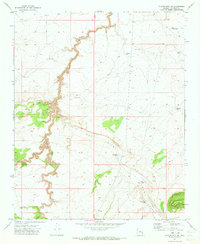
1971 Map of Chavez Mtn NE
USGS Topo · Published 1973About this map
Diablo Canyon carves a deep, winding path through the high desert plateau of Coconino County, serving as the central topographical feature of this 1971 field-checked survey. The landscape is defined by the high elevations of West Sunset Mtn and the broad expanse of Dog Valley, where the scarcity of natural water is evident through the naming of numerous man-made catchments. Cattle ranching infrastructure dominates the land use, represented by scattered features like Wolfolk Well, Dog Valley Tank, and a Corral. The presence of the Chavez Pass Ditch and various jeep trails suggests a remote area managed for grazing, while Grapevine Canyon joins the larger drainage network to the west. This survey captures a moment in Arizona's interior before significant modern development, documenting the functional relationship between the arid terrain and the ranching economy.
Find a feature on this map
21 named features on this map. Tap any name to fly to it.
Don’t see what you’re looking for? This feature index may not catch every label — zoom into the map to look around manually.
Map Details
Editions of this 1971 Chavez Mtn NE Map
This is the sole edition of this map. No revisions or reprints were ever made.
Other maps of this area

1883 · Tusayan
USGS Topo · 1:250,000

1886 · Tusayan
USGS Topo · 1:250,000

1886 · San Francisco Mtns
USGS Topo · 1:250,000

1886 · Holbrook
USGS Topo · 1:250,000

1887 · Verde
USGS Topo · 1:250,000

1891 · San Francisco Mtns
USGS Topo · 1:250,000

1892 · Verde
USGS Topo · 1:250,000

1893 · Holbrook
USGS Topo · 1:250,000

1894 · San Francisco Mtns
USGS Topo · 1:250,000

1899 · San Francisco Mtns
USGS Topo · 1:250,000