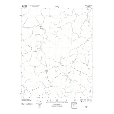
2010 Map of Check
USGS Topo · Published 2010About this map
Check and Simpsons anchor this section of the Blue Ridge plateau, where the landscape is defined by the winding drainages of the Little River and the headwaters of the South Fork Roanoke River. The road network follows the ridges and hollows, connecting smaller localities like Piedmont, Hemlock, and Copper Hill. Genealogists will find a high density of small family and community burial grounds, including Halls Cemetery, Salem Cemetery, Kefauver Cemetery, and the Poff Cemetery near Highland Haven Rd Ne. The transition from the steep relief of Lick Ridge down into the gentler valley of Meadow Run illustrates the rural character of Floyd County during this era. Further points of local interest include Camp Kiwanianna along Bottom Creek and the site of Willis Store on Shawsville Pike Ne.
Find a feature on this map
71 named features on this map. Tap any name to fly to it.
Don’t see what you’re looking for? This feature index may not catch every label — zoom into the map to look around manually.
Map Details
Editions of this 2010 Check Map
This is the sole edition of this map. No revisions or reprints were ever made.
Other maps of this area

1890 · Christiansburg
USGS Topo · 1:125,000

1932 · Blacksburg
USGS Topo · 1:48,000

1937 · Blacksburg
USGS Topo · 1:62,500

1950 · Elliston
USGS Topo · 1:62,500

1953 · Winston-Salem
USGS Topo · 1:250,000

1955 · Bluefield
USGS Topo · 1:250,000

1955 · Winston-Salem
USGS Topo · 1:250,000

1957 · Endicott
USGS Topo · 1:62,500

1957 · Floyd
USGS Topo · 1:62,500

1957 · Bluefield
USGS Topo · 1:250,000