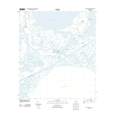
2012 Map of Chef Menteur
USGS Topo · Published 2012About this map
Chef Menteur Pass serves as a critical hydrologic artery in this coastal Louisiana landscape, connecting Lake Pontchartrain with Lake Borgne. The 2012 geography is dominated by a complex network of wetlands and tidal channels, including Bayou Sauvage and Bayou Bienvenue. Human habitation is concentrated in the master-planned waterfront community of Venetian Isles, where streets like San Remo Rd and Trieste St reflect the area's canal-oriented design.
Find a feature on this map
43 named features on this map. Tap any name to fly to it.
Don’t see what you’re looking for? This feature index may not catch every label — zoom into the map to look around manually.
Map Details
Editions of this 2012 Chef Menteur Map
This is the sole edition of this map. No revisions or reprints were ever made.
Other maps of this area

1892 · Chef Menteur
USGS Topo · 1:62,500

1892 · St. Bernard
USGS Topo · 1:62,500

1893 · Rigolets
USGS Topo · 1:62,500

1893 · Shell Beach
USGS Topo · 1:62,500

1936 · North Shore
USGS Topo · 1:31,680

1936 · South Point
USGS Topo · 1:31,680

1936 · Chef Menteur
USGS Topo · 1:62,500

1936 · Rigolets
USGS Topo · 1:62,500

1937 · Chef Menteur
USGS Topo · 1:31,680

1938 · Little Woods
USGS Topo · 1:31,680
Featured Places
- New Orleans, LA
- Greens Ditch, New Orleans
- Chef Menteur, New Orleans
- Venetian Isles, New Orleans
- Orleans Parish, LA