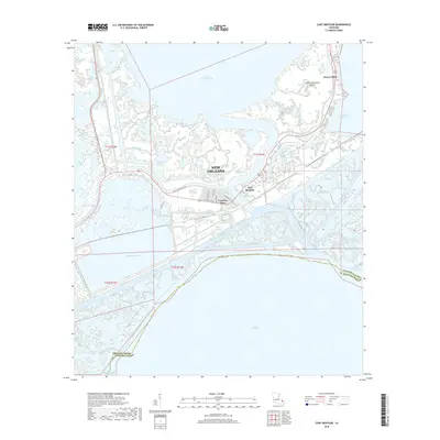
2018 Map of Chef Menteur
USGS Topo · Published 2018About this map
Chef Menteur Pass serves as a critical hydrologic artery in this eastern reach of New Orleans, connecting the waters of Lake Pontchartrain and Lake Borgne. The landscape is defined by an intricate network of wetlands and tidal channels, including Bayou Sauvage and Chico Lagoon, which separate the developed pockets of Venetian Isles and Chef Menteur from the broader marshes of the Mississippi River Delta. This 2018 survey illustrates the complex relationship between coastal infrastructure and the environment, where the Intracostal Waterway cuts through native drainages like Bayou Thomas and Bayou Martinez. Historically significant transport corridors like the Old Spanish Trl and Old Chef Menteur Rd navigate this saturated terrain, providing land access to isolated points such as Saint Catherines Island and the northern reaches of the Orleans Parish and St. Bernard Parish boundary.
Find a feature on this map
45 named features on this map. Tap any name to fly to it.
Don’t see what you’re looking for? This feature index may not catch every label — zoom into the map to look around manually.
Map Details
Editions of this 2018 Chef Menteur Map
This is the sole edition of this map. No revisions or reprints were ever made.
Other maps of this area

1892 · Chef Menteur
USGS Topo · 1:62,500

1892 · St. Bernard
USGS Topo · 1:62,500

1893 · Rigolets
USGS Topo · 1:62,500

1893 · Shell Beach
USGS Topo · 1:62,500

1936 · North Shore
USGS Topo · 1:31,680

1936 · South Point
USGS Topo · 1:31,680

1936 · Chef Menteur
USGS Topo · 1:62,500

1936 · Rigolets
USGS Topo · 1:62,500

1937 · Chef Menteur
USGS Topo · 1:31,680

1938 · Little Woods
USGS Topo · 1:31,680
Featured Places
- New Orleans, LA
- Greens Ditch, New Orleans
- Chef Menteur, New Orleans
- Venetian Isles, New Orleans
- Orleans Parish, LA