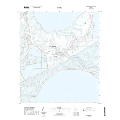
2020 Map of Chef Menteur
USGS Topo · Published 2020About this map
The Chef Menteur Pass serves as a vital natural conduit between Lake Pontchartrain and Lake Borgne, anchoring a landscape defined by an intricate network of coastal waterways. Within this eastern reach of New Orleans, the residential enclave of Venetian Isles stands as a testament to mid-century marshland development, situated along the historic routes of Old Chef Menteur Rd and the Old Spanish Trl.
Find a feature on this map
41 named features on this map. Tap any name to fly to it.
Don’t see what you’re looking for? This feature index may not catch every label — zoom into the map to look around manually.
Map Details
Editions of this 2020 Chef Menteur Map
This is the sole edition of this map. No revisions or reprints were ever made.
Other maps of this area

1892 · Chef Menteur
USGS Topo · 1:62,500

1892 · St. Bernard
USGS Topo · 1:62,500

1893 · Rigolets
USGS Topo · 1:62,500

1893 · Shell Beach
USGS Topo · 1:62,500

1936 · North Shore
USGS Topo · 1:31,680

1936 · South Point
USGS Topo · 1:31,680

1936 · Chef Menteur
USGS Topo · 1:62,500

1936 · Rigolets
USGS Topo · 1:62,500

1937 · Chef Menteur
USGS Topo · 1:31,680

1938 · Little Woods
USGS Topo · 1:31,680
Featured Places
- New Orleans, LA
- Greens Ditch, New Orleans
- Chef Menteur, New Orleans
- Venetian Isles, New Orleans
- Orleans Parish, LA