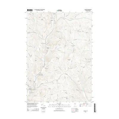
2015 Map of Chelsea
USGS Topo · Published 2015About this map
Chelsea and the surrounding townships of North Tunbridge and Tunbridge are defined by a network of valley roads and historic spans across the First Br White River. This 2015 survey reveals a landscape deeply connected to its 19th-century infrastructure, prominently featuring several operational landmarks including the Moxley Covered Bridge, Flint Covered Bridge, and Larkin Covered Bridge. These structures represent a preserved architectural heritage that continues to serve the rural road system.
Find a feature on this map
121 named features on this map. Tap any name to fly to it.
Don’t see what you’re looking for? This feature index may not catch every label — zoom into the map to look around manually.
Map Details
Editions of this 2015 Chelsea Map
This is the sole edition of this map. No revisions or reprints were ever made.
Other maps of this area

1896 · Strafford
USGS Topo · 1:62,500

1919 · Royalton
USGS Topo · 1:62,500

1922 · Barre
USGS Topo · 1:48,000

1924 · Barre
USGS Topo · 1:62,500

1924 · Randolph
USGS Topo · 1:48,000

1926 · Randolph
USGS Topo · 1:62,500

1944 · Strafford
USGS Topo · 1:62,500

1947 · Corinth
USGS Topo · 1:62,500

1948 · East Barre
USGS Topo · 1:62,500

1950 · Glens Falls
USGS Topo · 1:250,000