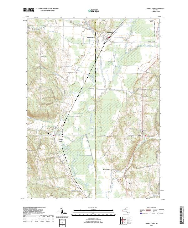
2023 Map of Cherry Creek
USGS Topo · Published 2023About this map
The valley of Conewango Creek serves as the primary corridor for this 2023 survey of Western New York, delineating the boundary between Chautauqua and Cattaraugus counties. The village of South Dayton anchors the northern reaches of the map, characterized by a grid of streets including Allegany Rd and Pine St near the South Dayton Airport. To the southwest, the town of Cherry Creek sits at the junction of South Rd and Center St, serving as a gateway to the elevations of Aldrich Hill and Pickup Hill. The landscape transitions from these higher grounds into the low-lying wetlands surrounding the Dredge Ditch and its various tributaries like Blaisdell Creek. Genealogists will find interest in the documented burial grounds at Highland Cem near the Cherry Creek settlement and Union Cem situated near the village of Leon.
Find a feature on this map
83 named features on this map. Tap any name to fly to it.
Don’t see what you’re looking for? This feature index may not catch every label — zoom into the map to look around manually.
Map Details
Editions of this 2023 Cherry Creek Map
This is the sole edition of this map. No revisions or reprints were ever made.
Other maps of this area

1900 · Cherry Creek
USGS Topo · 1:62,500

1905 · Jamestown
USGS Topo · 1:62,500

1922 · Randolph
USGS Topo · 1:62,500

1923 · Randolph
USGS Topo · 1:62,500

1923 · Cattaraugus
USGS Topo · 1:62,500

1938 · Cattaraugus
USGS Topo · 1:62,500

1941 · Cattaraugus
USGS Topo · 1:62,500

1941 · Cherry Creek
USGS Topo · 1:62,500

1942 · Jamestown
USGS Topo · 1:62,500

1943 · Randolph
USGS Topo · 1:62,500