Loading...
Loading map...2021 Map of Cherry Creek
USGS Topo · Published 2021About this map
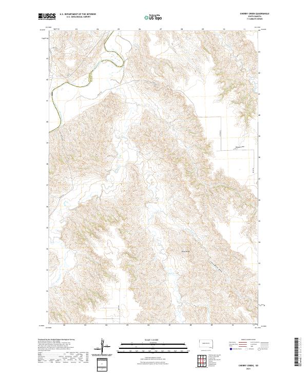
The Cheyenne River carves a significant course through this landscape along the Ziebach County and Haakon County boundary. The terrain is defined by a dense network of drainages, most notably the extensive Plum Creek system, including West Plum Creek and the East Fork Plum Creek. These waterways create a highly dissected topography, contrasting with the elevated plateau of Maupin Flat in the northeast.
Find a feature on this map
23 named features on this map. Tap any name to fly to it.
Don’t see what you’re looking for? This feature index may not catch every label — zoom into the map to look around manually.
Map Details
Date Portrayed2021
Date Published2021
PublisherU.S. Geological Survey
Map TypeTopographic
Scale1:24000
Physical Dimensions24 x 29 inches
Editions of this 2021 Cherry Creek Map
This is the sole edition of this map. No revisions or reprints were ever made.
Historical Maps of District 3 Through Time
3 maps found
Featured Locations
Source Details
SourceU.S. Geological Survey
CopyrightPublic Domain