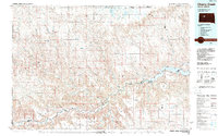
1986 Map of Cherry Creek
USGS Topo · Published 1989About this map
The Cheyenne River carves a winding path through the center of this mid-1980s landscape, marking the northern reach of the Cheyenne River Indian Reservation Boundary. The settlement of Cherry Creek sits at a critical junction where its namesake stream meets the river, surrounded by expansive geographic features like Robbs Flat and Maupin Flat. To the east, the waters of Lake Oahe reach into the terrain, creating a complex shoreline along Marion Flats.
Find a feature on this map
67 named features on this map. Tap any name to fly to it.
Don’t see what you’re looking for? This feature index may not catch every label — zoom into the map to look around manually.
Map Details
Editions of this 1986 Cherry Creek Map
2 editions found
Other maps of this area

1953 · Rapid City
USGS Topo · 1:250,000

1953 · McIntosh
USGS Topo · 1:250,000

1954 · Lemmon
USGS Topo · 1:250,000

1954 · Pierre
USGS Topo · 1:250,000

1955 · Bridger
USGS Topo · 1:24,000

1955 · Rattlesnake Lake SE
USGS Topo · 1:24,000

1955 · Pedro
USGS Topo · 1:24,000

1955 · Rattlesnake Lake SW
USGS Topo · 1:24,000

1955 · Rattlesnake Lake
USGS Topo · 1:24,000

1955 · Rattlesnake Lake NE
USGS Topo · 1:24,000