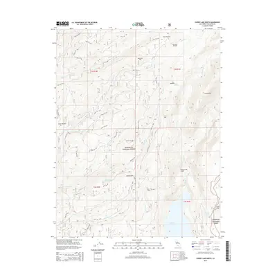
2015 Map of Cherry Lake North
USGS Topo · Published 2015About this map
The Stanislaus National Forest and a portion of Yosemite National Park dominate this high-country landscape in Tuolumne County. This 2015 survey illustrates the drainage systems feeding into Cherry Lake at the southern edge of the map, including Cherry Creek and its deep Cherry Creek Canyon. The terrain is defined by dramatic elevation changes, rising toward Kibbie Ridge and Cherry Ridge. An extensive network of Forest Service routes, such as Forest Rte 3N16 and Rock Creek Rd, provides access to remote high-altitude features like Bourland Mtn and Hells Mtn. Numerous meadows, including Bourland Meadow and Clavey Meadow, are scattered throughout the granite-rich terrain of the Sierra Nevada, offering insight into the hydrological and grazing history of the region. Local landmarks like Jawbone Falls and the isolated Shingle Spring serve as critical points of interest for backcountry navigation.
Find a feature on this map
52 named features on this map. Tap any name to fly to it.
Don’t see what you’re looking for? This feature index may not catch every label — zoom into the map to look around manually.
Map Details
Editions of this 2015 Cherry Lake North Map
This is the sole edition of this map. No revisions or reprints were ever made.
Other maps of this area

1891 · Big Trees
USGS Topo · 1:125,000

1893 · Sonora
USGS Topo · 1:125,000

1894 · Big Trees
USGS Topo · 1:125,000

1896 · Dardanelles
USGS Topo · 1:125,000

1896 · Sonora
USGS Topo · 1:125,000

1897 · Sonora
USGS Topo · 1:125,000

1897 · Big Trees
USGS Topo · 1:125,000

1897 · Yosemite
USGS Topo · 1:125,000

1898 · Dardanelles
USGS Topo · 1:125,000

1898 · Sonora
USGS Topo · 1:125,000