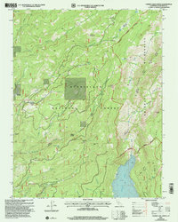
2001 Map of Cherry Lake North
USGS Topo · Published 2004About this map
Stanislaus National Forest and the northwestern edge of Yosemite National Park dominate this high-country landscape at the turn of the millennium. The terrain is defined by the deep drainage of the Clavey River and the West Fork of Cherry Creek, which feeds into the prominent Cherry Lake reservoir. Human activity is evidenced by industrial and forestry infrastructure, including the Bourland Quarry and Jawbone Quarry, which supported regional maintenance within the forest. The map captures the boundary between managed forest land and the Emigrant Wilderness, where landmarks like Bourland Mountain and Hells Mountain rise above meadow systems such as Weed Meadow and Clavey Meadow. This 2001 revision illustrates the complex management of public lands, showing the network of forest roads and trails that connect remote points like Lookout Point and the dramatic Jawbone Falls.
Find a feature on this map
39 named features on this map. Tap any name to fly to it.
Don’t see what you’re looking for? This feature index may not catch every label — zoom into the map to look around manually.
Map Details
Editions of this 2001 Cherry Lake North Map
This is the sole edition of this map. No revisions or reprints were ever made.
Other maps of this area

1891 · Big Trees
USGS Topo · 1:125,000

1893 · Sonora
USGS Topo · 1:125,000

1894 · Big Trees
USGS Topo · 1:125,000

1896 · Dardanelles
USGS Topo · 1:125,000

1896 · Sonora
USGS Topo · 1:125,000

1897 · Sonora
USGS Topo · 1:125,000

1897 · Big Trees
USGS Topo · 1:125,000

1897 · Yosemite
USGS Topo · 1:125,000

1898 · Dardanelles
USGS Topo · 1:125,000

1898 · Sonora
USGS Topo · 1:125,000