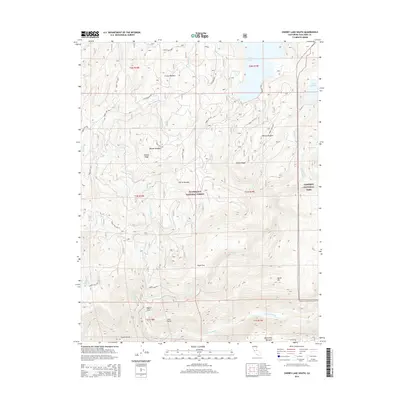
2015 Map of Cherry Lake South
USGS Topo · Published 2015About this map
Stanislaus National Forest and the northwestern edge of Yosemite National Park meet in this high-country survey of Tuolumne County. The landscape is defined by the significant reservoir at Cherry Lake and the smaller Lake Eleanor, linked by a complex drainage system including Cherry Cr and Eleanor Cr. The topography descends sharply toward the south, where the Tuolumne River carves through the terrain near Preston Falls. High-altitude grazing and transit are evident in named meadows and flats such as Crane Meadow, Wilson Meadow, and Plum Flat. A network of Forest Service routes, including Cherry Lake Rd and Cottonwood Rd, provides the primary access across ridges like Kibbie Ridge and Woods Ridge. This map captures the region's character as a critical watershed and protected wilderness area, highlighting remote points of interest like Joes Point and North Mtn used by backcountry travelers and forestry workers.
Find a feature on this map
46 named features on this map. Tap any name to fly to it.
Don’t see what you’re looking for? This feature index may not catch every label — zoom into the map to look around manually.
Map Details
Editions of this 2015 Cherry Lake South Map
This is the sole edition of this map. No revisions or reprints were ever made.
Other maps of this area

1891 · Big Trees
USGS Topo · 1:125,000

1893 · Sonora
USGS Topo · 1:125,000

1894 · Big Trees
USGS Topo · 1:125,000

1896 · Dardanelles
USGS Topo · 1:125,000

1896 · Sonora
USGS Topo · 1:125,000

1897 · Sonora
USGS Topo · 1:125,000

1897 · Big Trees
USGS Topo · 1:125,000

1897 · Yosemite
USGS Topo · 1:125,000

1898 · Dardanelles
USGS Topo · 1:125,000

1898 · Sonora
USGS Topo · 1:125,000