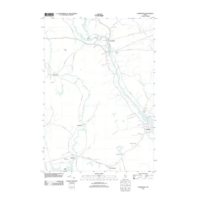
2011 Map of Cherryfield
USGS Topo · Published 2011About this map
The Narraguagus River flows through the heart of this Downeast coastal landscape, branching at the distinctive junction known as the Crotch. The village of Cherryfield serves as a historic center for the region, where the Cherryfield Dam and river access once drove local industry. To the south, the coastal community of Milbridge sits near the mouth of the river, while smaller settlements like Smithville, Unionville, and Steuben are connected by a network of rural roads such as Old County Rd and Unionville Rd.
Find a feature on this map
69 named features on this map. Tap any name to fly to it.
Don’t see what you’re looking for? This feature index may not catch every label — zoom into the map to look around manually.
Map Details
Editions of this 2011 Cherryfield Map
This is the sole edition of this map. No revisions or reprints were ever made.
Other maps of this area

1902 · Cherryfield
USGS Topo · 1:62,500

1904 · Cherryfield
USGS Topo · 1:62,500

1904 · Bar Harbor
USGS Topo · 1:62,500

1904 · Petit Manan
USGS Topo · 1:62,500

1930 · Tunk Lake
USGS Topo · 1:48,000

1932 · Tunk Lake
USGS Topo · 1:62,500

1942 · Bar Harbor
USGS Topo · 1:62,500

1942 · Cherryfield
USGS Topo · 1:62,500

1942 · Tunk Lake
USGS Topo · 1:62,500

1948 · Bangor
USGS Topo · 1:250,000