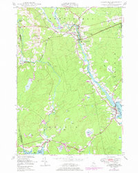
1948 Map of Cherryfield
USGS Topo · Published 1978About this map
Cherryfield serves as the inland hub of this Washington County landscape, situated where the Maine Central railroad crosses the Narraguagus River. Downstream, the river broadens toward the coastal settlement of Milbridge, a port area defined by its proximity to Steuben Harbor and Joy Cove. The topographic data, based on 1940s surveys and 1970s revisions, illustrates a maritime and river-driven economy connecting the timber-rich interior to the Atlantic coast. Small hamlets like Unionville, Smithville, and East Steuben are linked by the rail line and a network of coastal roads. Notable landmarks include Burke Hill and several cemeteries, such as Evergreen Cem, which provide valuable location data for genealogists. The terrain is marked by numerous low-lying wetlands known as Heath, which surround the branching waterways of Tunk Stream and the West Branch Narraguagus River.
Find a feature on this map
33 named features on this map. Tap any name to fly to it.
Don’t see what you’re looking for? This feature index may not catch every label — zoom into the map to look around manually.
Map Details
Editions of this 1948 Cherryfield Map
This is the sole edition of this map. No revisions or reprints were ever made.
Other maps of this area

1902 · Cherryfield
USGS Topo · 1:62,500

1904 · Cherryfield
USGS Topo · 1:62,500

1904 · Bar Harbor
USGS Topo · 1:62,500

1904 · Petit Manan
USGS Topo · 1:62,500

1930 · Tunk Lake
USGS Topo · 1:48,000

1932 · Tunk Lake
USGS Topo · 1:62,500

1942 · Bar Harbor
USGS Topo · 1:62,500

1942 · Cherryfield
USGS Topo · 1:62,500

1942 · Tunk Lake
USGS Topo · 1:62,500

1948 · Bangor
USGS Topo · 1:250,000