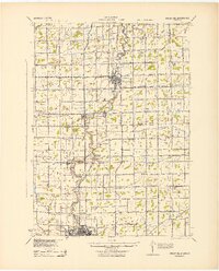
1943 Map of Chesaning
USGS Topo · Published 1943About this map
The Shiawassee River anchors this mid-century landscape, flowing north through the central corridor and connecting the industrial hub of Owosso with the riverside settlements of Oakley, Parshallburg, and Chesaning. This era reveals a dense network of rural infrastructure, where nearly every section corner supports a local education site such as Pioneer Sch, Ziegler Sch, or Forest Lawn Sch. This distribution of schoolhouses across the Saginaw County and Shiawassee County border highlights the settled, agricultural character of the region during the early 1940s.
Find a feature on this map
71 named features on this map. Tap any name to fly to it.
Don’t see what you’re looking for? This feature index may not catch every label — zoom into the map to look around manually.
Map Details
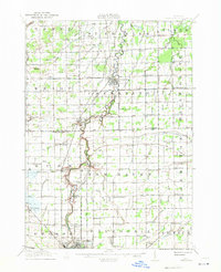
Editions of this 1943 Chesaning Map
This is the sole edition of this map. No revisions or reprints were ever made.
Historical Maps of Owosso Through Time
Featured Locations
- New Haven Township, MI
- Owosso, MI
- Chesaning, Chesaning Township
- Oakley, Brady Township
- New Haven, New Haven Township