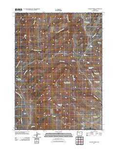
2011 Map of Chicken Spring
USGS Topo · Published 2011About this map
Sherman Field and a high-desert network of water management features define this corner of Malheur County in the early 21st century. The landscape is characterized by its drainage systems, including McDermitt Creek and the East Fork Big Trout Creek, which feed into numerous small impoundments. These reservoirs, such as Tadpole Spring Reservoir, Funny Face Reservoir, and Rough Hole Reservoir, illustrate the critical importance of water storage in this arid environment for ranching or land management.
Find a feature on this map
25 named features on this map. Tap any name to fly to it.
Don’t see what you’re looking for? This feature index may not catch every label — zoom into the map to look around manually.
Map Details
Editions of this 2011 Chicken Spring Map
This is the sole edition of this map. No revisions or reprints were ever made.
Other maps of this area

1886 · Disaster
USGS Topo · 1:250,000

1893 · Disaster
USGS Topo · 1:250,000

1954 · Vya
USGS Topo · 1:250,000

1955 · Adel
USGS Topo · 1:250,000

1957 · Adel
USGS Topo · 1:250,000

1958 · Vya
USGS Topo · 1:250,000

1958 · Adel
USGS Topo · 1:250,000

1961 · Trident Peak
USGS Topo · 1:62,500

1961 · Disaster Peak
USGS Topo · 1:62,500

1962 · Vya
USGS Topo · 1:250,000