
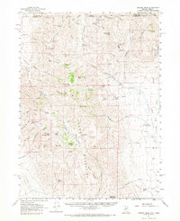
1961 Map of Trident Peak
USGS Topo · Published 1963About this map
The Bilk Creek Mountains dominate this high-desert landscape along the border of Nevada and Oregon in the early 1960s. Rangeland infrastructure like Miller Corral and numerous water sources including Miller Trough and Crow Creek Spr suggest a landscape geared toward livestock, while a network of jeep trails connects remote outposts and former habitations. Evidence of earlier human activity is scattered throughout the drainages, notably at Jack Spade Cabin and Ayers Cabin.
Find a feature on this map
72 named features on this map. Tap any name to fly to it.
Don’t see what you’re looking for? This feature index may not catch every label — zoom into the map to look around manually.
Map Details
Editions of this 1961 Trident Peak Map
2 editions found
Other maps of this area

1886 · Disaster
USGS Topo · 1:250,000

1893 · Disaster
USGS Topo · 1:250,000

1954 · Vya
USGS Topo · 1:250,000

1955 · Adel
USGS Topo · 1:250,000

1957 · Adel
USGS Topo · 1:250,000

1958 · Vya
USGS Topo · 1:250,000

1958 · Adel
USGS Topo · 1:250,000

1961 · Quinn River Crossing
USGS Topo · 1:62,500

1961 · Thacker Pass
USGS Topo · 1:62,500

1961 · Disaster Peak
USGS Topo · 1:62,500