
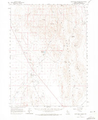
1961 Map of Quinn River Crossing
USGS Topo · Published 1962About this map
The high desert landscape of Humboldt County, Nevada, is centered on Quinn River Crossing, a historical hub of movement across the basin at the start of the 1960s. This survey illustrates a reliance on precious water sources in an arid environment, with numerous vital points such as Paine Well, Mud Spr, and De Long Spr dotting the terrain. The presence of Bilk Creek Reservoir and irrigation-related infrastructure like the Hay Quinn River Well reflects the agricultural footprint in the Kings River Valley and along the Quinn River. To the east, the terrain rises sharply into the Jackson Mountains, where labels like Black Mtn and Ninemile Summit define the high country. For genealogists and local historians, the map identifies ranching sites like Nine Mile Ranch and transient locations such as Quinn River Camp, linked by the primitive Winnemucca Denio Road and various jeep trails.
Find a feature on this map
34 named features on this map. Tap any name to fly to it.
Don’t see what you’re looking for? This feature index may not catch every label — zoom into the map to look around manually.
Map Details
Editions of this 1961 Quinn River Crossing Map
2 editions found
Other maps of this area

1886 · Disaster
USGS Topo · 1:250,000

1893 · Disaster
USGS Topo · 1:250,000

1954 · Vya
USGS Topo · 1:250,000

1958 · Vya
USGS Topo · 1:250,000

1961 · Thacker Pass
USGS Topo · 1:62,500

1961 · Trident Peak
USGS Topo · 1:62,500

1961 · Bottle Creek
USGS Topo · 1:62,500

1961 · Disaster Peak
USGS Topo · 1:62,500

1962 · Vya
USGS Topo · 1:250,000

1965 · Duffer Peak
USGS Topo · 1:62,500