2021 Map of Chilhowee
USGS Topo · Published 2021About this map
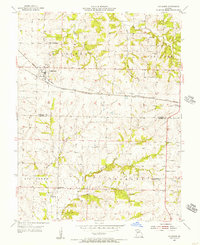
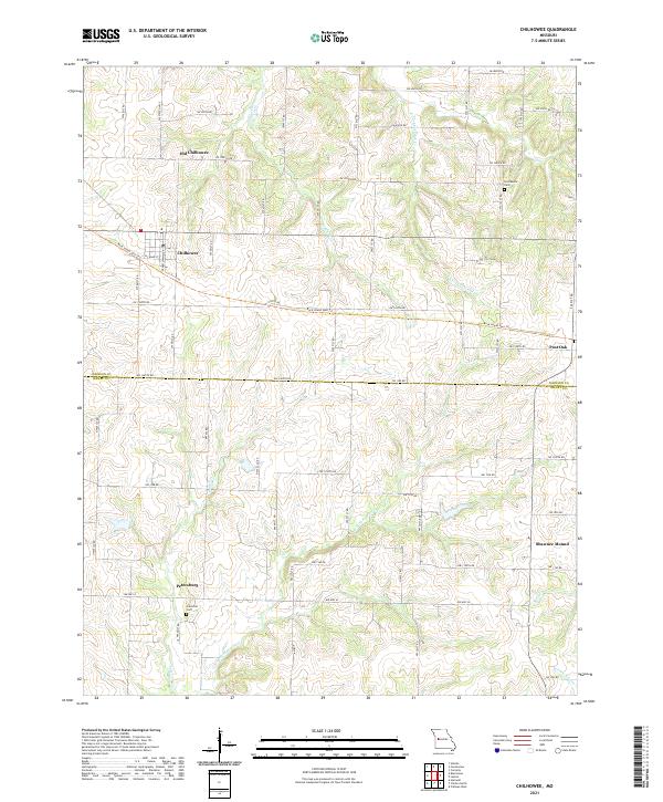
Chilhowee serves as the central hub of this agricultural landscape in west-central Missouri, situated near the boundary where Johnson Co meets Henry Co. The area is defined by the legacy of rail transit, evidenced by the Rock Island Spur Trl that cuts across the terrain, replacing the path of the former Rock Island Line. To the north, the distinction between the primary settlement and Old Chilhowee reflects the historical shifts in community centers over time. Smaller rural hamlets like Post Oak, Petersburg, and Shawnee Mound are dispersed throughout the region, connected by a network of rural routes such as SW State Hwy F. The landscape is deeply etched by a complex drainage system including Hagan Fork, E Fork Post Oak Cr, and E Fork Honey Cr. Genealogists will find interest in the documented locations of the Providence Cem and Carrsville Cem, which anchor the history of early families in the township.
Find a feature on this map
62 named features on this map. Tap any name to fly to it.
Don’t see what you’re looking for? This feature index may not catch every label — zoom into the map to look around manually.
Map Details
Editions of this 2021 Chilhowee Map
This is the sole edition of this map. No revisions or reprints were ever made.