1955 Map of Chilhowee
USGS Topo · Published 1956About this map
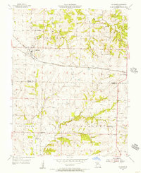
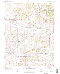
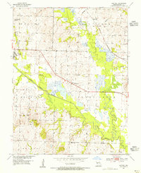
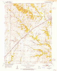
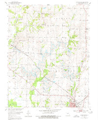
The boundary between Johnson and Henry counties serves as the backdrop for this mid-century look at West Central Missouri. The settlement of Chilhowee is a central hub, situated along the tracks of the Chicago Texas and Missouri Pacific Kansas and Texas Railroad. To its north, Old Chilhowee points to an earlier stage of the community’s development. The landscape is defined by the drainage of Big Creek and its tributaries, including Honey Creek and the East Fork Post Oak Creek.
Find a feature on this map
23 named features on this map. Tap any name to fly to it.
Don’t see what you’re looking for? This feature index may not catch every label — zoom into the map to look around manually.
Map Details
Editions of this 1955 Chilhowee Map
2 editions found
Other maps of this area

1885 · Warrensburg
USGS Topo · 1:125,000

1887 · Clinton
USGS Topo · 1:125,000

1887 · Warrensburg
USGS Topo · 1:125,000

1894 · Warrensburg
USGS Topo · 1:125,000

1894 · Clinton
USGS Topo · 1:125,000

1947 · Jefferson City
USGS Topo · 1:250,000
1953 · Hartwell
USGS Topo · 1:24,000
1953 · Calhoun West
USGS Topo · 1:24,000
1953 · Clinton North
USGS Topo · 1:24,000

1954 · Jefferson City
USGS Topo · 1:250,000