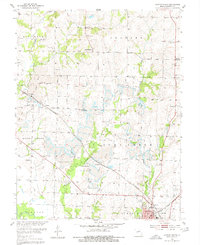
1953 Map of Clinton North
USGS Topo · Published 1980About this map
Clinton serves as a central hub on this Missouri survey, which shows a landscape defined by the intersection of industrial activity and rural community life. The southern edge of the map features the complex rail junctions of the St Louis San Francisco and the Missouri Kansas Texas lines, underscoring the era's transport-driven economy. This industrial presence is contrasted by numerous Strip Mine operations that cut across the watersheds of Fields Creek and Honey Cr, fundamentally altering the local topography between the settlements of Livingston and Garland.
Find a feature on this map
39 named features on this map. Tap any name to fly to it.
Don’t see what you’re looking for? This feature index may not catch every label — zoom into the map to look around manually.
Map Details
Editions of this 1953 Clinton North Map
3 editions found
Other maps of this area

1885 · Warrensburg
USGS Topo · 1:125,000

1887 · Clinton
USGS Topo · 1:125,000

1887 · Warrensburg
USGS Topo · 1:125,000

1894 · Warrensburg
USGS Topo · 1:125,000

1894 · Clinton
USGS Topo · 1:125,000

1947 · Jefferson City
USGS Topo · 1:250,000

1953 · Gaines
USGS Topo · 1:24,000

1953 · Montrose
USGS Topo · 1:24,000

1953 · Hartwell
USGS Topo · 1:24,000

1953 · Clinton South
USGS Topo · 1:24,000