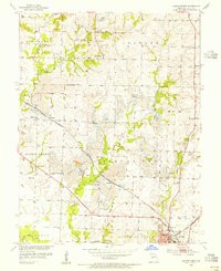
1953 Map of Clinton North
USGS Topo · Published 1995About this map
Extensive industrial activity is visible just north of Clinton in the mid-1950s, where heavy Strip Mine operations have altered the landscape between Honey Creek and Fields Creek. This Henry County region shows a clear intersection of natural drainage and human industry, with the St Louis San Francisco railroad cutting through small rural clusters like Harvey and Huntingdale. The rural education and burial patterns of the era are well-documented, from the Garland Sch in the west to the Comer Sch near the settlement of Quarles in the east. Genealogical details are abundant, including the Fields Creek Cem and Freeman Cem. In the southeastern corner, the outskirts of Clinton reveal a transitioning town infrastructure featuring a Landing Field, a Radio Tower (KDKD), and proximity to the Missouri Kansas Texas rail line.
Find a feature on this map
40 named features on this map. Tap any name to fly to it.
Don’t see what you’re looking for? This feature index may not catch every label — zoom into the map to look around manually.
Map Details
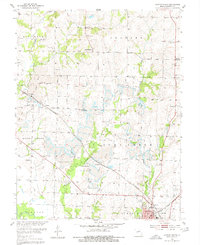
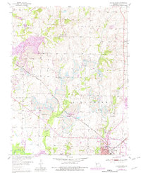
Editions of this 1953 Clinton North Map
3 editions found
Other maps of this area

1885 · Warrensburg
USGS Topo · 1:125,000

1887 · Clinton
USGS Topo · 1:125,000

1887 · Warrensburg
USGS Topo · 1:125,000

1894 · Warrensburg
USGS Topo · 1:125,000

1894 · Clinton
USGS Topo · 1:125,000

1947 · Jefferson City
USGS Topo · 1:250,000

1953 · Gaines
USGS Topo · 1:24,000

1953 · Montrose
USGS Topo · 1:24,000

1953 · Hartwell
USGS Topo · 1:24,000

1953 · Clinton South
USGS Topo · 1:24,000