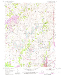
1953 Map of Clinton North
USGS Topo · Published 1982About this map
Industrial coal mining and agricultural life intersect in this survey of northern Henry County. Extensive Strip Mine operations dominate the landscape between Huntingdale and the northern outskirts of Clinton, leaving a distinct pattern of excavation and access roads across the Fields Creek terrain. These active industrial sites operate alongside long-standing rural institutions, including the Lincoln Sch and Fields Creek Sch, and numerous family and community burial grounds such as Antioch Cem and Paul Cem.
Find a feature on this map
45 named features on this map. Tap any name to fly to it.
Don’t see what you’re looking for? This feature index may not catch every label — zoom into the map to look around manually.
Map Details
Editions of this 1953 Clinton North Map
3 editions found
Other maps of this area

1885 · Warrensburg
USGS Topo · 1:125,000

1887 · Clinton
USGS Topo · 1:125,000

1887 · Warrensburg
USGS Topo · 1:125,000

1894 · Warrensburg
USGS Topo · 1:125,000

1894 · Clinton
USGS Topo · 1:125,000

1947 · Jefferson City
USGS Topo · 1:250,000

1953 · Gaines
USGS Topo · 1:24,000

1953 · Montrose
USGS Topo · 1:24,000

1953 · Hartwell
USGS Topo · 1:24,000

1953 · Clinton South
USGS Topo · 1:24,000