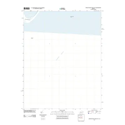
2011 Map of Chincoteague East OE S
USGS Topo · Published 2011About this map
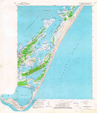
Assateague Island anchors the northwestern corner of this coastal survey, where the land gives way to the open Atlantic Ocean. This map documents a dynamic marine environment defined by shifting underwater features and the protected waters of Toms Cove. The majority of the quadrangle covers the offshore shelf, providing a detailed look at the navigational hazards and shoals that define this stretch of the Virginia coastline. Features such as the Chincoteague Shoals and the submerged rise known as Turners Lump reflect the complex bathymetry of the region. Produced without contour data, the sheet focuses on the relationship between the barrier island landforms and the surrounding sea, capturing the shoreline of the Accomack County coast as it existed in the early twenty-first century.
Find a feature on this map
5 named features on this map. Tap any name to fly to it.
Don’t see what you’re looking for? This feature index may not catch every label — zoom into the map to look around manually.
Map Details
Editions of this 2011 Chincoteague East OE S Map
This is the sole edition of this map. No revisions or reprints were ever made.
Other maps of this area

1942 · Chincoteague East
USGS Topo · 1:24,000

1942 · Wallops Island
USGS Topo · 1:24,000

1943 · Chincoteague West
USGS Topo · 1:31,680

1943 · Wallops Island
USGS Topo · 1:31,680
1943 · Chincoteague East
USGS Topo · 1:31,680

1946 · Eastville
USGS Topo · 1:250,000

1961 · Eastville
USGS Topo · 1:250,000
1965 · Chincoteague West
USGS Topo · 1:24,000
1965 · Wallops Island
USGS Topo · 1:24,000
1965 · Chincoteague East
USGS Topo · 1:24,000