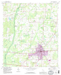
1994 Map of Chipley
USGS Topo · Published 1995About this map
The municipal core of Chipley sits at the meeting point of Washington, Jackson, and Holmes counties, serving as a regional hub for the Florida Panhandle during the late twentieth century. This survey documents the intersection of modern infrastructure and rural tradition, featuring the Vocational Tech Center and Roulhac Middle Sch alongside several country churches like Salem Ch and Holmes Creek Ch. The landscape to the north and west is defined by a complex network of bays and wetlands, including Double Spring Bay, Wolf Bay, and Register Bay, which drain into the prominent Holmes Creek waterway. Industrial and recreational markers of the era are visible, such as the Drive-in Theater west of town and various Claypit operations on the outskirts. Genealogists will find several burial grounds mapped, notably Glenwood Cem and Mt Zion Cem, which anchor the surrounding communities of Richter Crossroads and Bahoma.
Find a feature on this map
49 named features on this map. Tap any name to fly to it.
Don’t see what you’re looking for? This feature index may not catch every label — zoom into the map to look around manually.
Map Details
Editions of this 1994 Chipley Map
This is the sole edition of this map. No revisions or reprints were ever made.
Other maps of this area

1950 · Chipley
USGS Topo · 1:24,000

1950 · Wausau
USGS Topo · 1:24,000

1950 · Esto
USGS Topo · 1:24,000

1950 · Poplar Head
USGS Topo · 1:24,000

1951 · Graceville
USGS Topo · 1:24,000

1951 · Esto
USGS Topo · 1:24,000

1951 · Chipley
USGS Topo · 1:24,000

1951 · Wausau
USGS Topo · 1:24,000
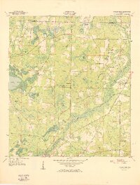
1951 · Poplar Head
USGS Topo · 1:24,000

1951 · Bonifay
USGS Topo · 1:24,000