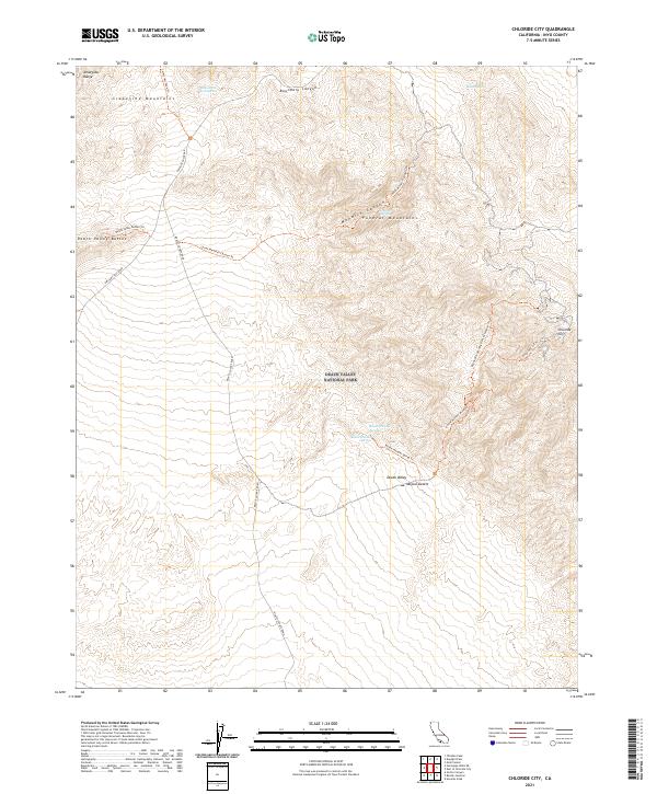
2021 Map of Chloride City
USGS Topo · Published 2021About this map
The high desert convergence of the Grapevine Mountains and the Funeral Mountains dominates this portion of Death Valley National Park. In an environment defined by extreme topography and aridity, the location of water is the primary driver of human movement, evidenced by the cluster of paths near Keane Wonder Springs and Keane Spring. Historically significant routes, including the Beatty Cutoff Road and Daylight Pass Road, navigate the dramatic transitions between the peaks and the floor of the Mojave Desert. The map meticulously details the network of footpaths leading to high-elevation vantage points like Chloride Cliff and Death Valley Buttes, tracing the infrastructure of early mining access and modern backcountry exploration. This 2021 survey provides a clear view of the springs, such as Hole-in-the Rock Spring, that have long served as essential landmarks for travelers in the Amargosa Range.
Find a feature on this map
28 named features on this map. Tap any name to fly to it.
Don’t see what you’re looking for? This feature index may not catch every label — zoom into the map to look around manually.
Map Details
Editions of this 2021 Chloride City Map
This is the sole edition of this map. No revisions or reprints were ever made.
Other maps of this area

1908 · Furnace Creek
USGS Topo · 1:250,000

1908 · Ballarat
USGS Topo · 1:250,000

1910 · Furnace Creek
USGS Topo · 1:250,000

1913 · Ballarat
USGS Topo · 1:250,000

1942 · Bullfrog
USGS Topo · 1:125,000

1948 · Death Valley
USGS Topo · 1:250,000

1952 · Chloride Cliff
USGS Topo · 1:50,000

1952 · Stovepipe Wells
USGS Topo · 1:62,500

1954 · Bullfrog
USGS Topo · 1:62,500

1954 · Death Valley
USGS Topo · 1:250,000