
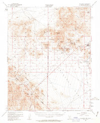
1954 Map of Bullfrog
USGS Topo · Published 1955About this map
Rhyolite stands as a focal point of this mid-century desert survey, shown as a significant site of former mining activity alongside the Bullfrog (Ruins). The landscape is defined by the extraction economy of the early 20th century, with numerous named claims such as the Montgomery-Shoshone Mine, Original Bullfrog Mine, and Ladd Mine dotting the slopes of Bullfrog Mtn and Rainbow Mtn. The town of Beatty serves as the regional hub, situated in the Oasis Valley near the Amargosa Narrows. A Dismantled Railroad trace reveals the fading industrial connectivity that once linked these remote camps to broader markets. To the southwest, the Von Schmidt Line marks the state boundary within the Death Valley National Monument, while topographic details capture the stark transition from the Amargosa Desert to the high peaks of the Grapevine Mountains.
Find a feature on this map
49 named features on this map. Tap any name to fly to it.
Don’t see what you’re looking for? This feature index may not catch every label — zoom into the map to look around manually.
Map Details
Editions of this 1954 Bullfrog Map
3 editions found
Other maps of this area

1908 · Kawich
USGS Topo · 1:250,000

1908 · Lida
USGS Topo · 1:250,000

1908 · Furnace Creek
USGS Topo · 1:250,000

1908 · Ballarat
USGS Topo · 1:250,000

1910 · Furnace Creek
USGS Topo · 1:250,000

1913 · Lida
USGS Topo · 1:250,000

1913 · Ballarat
USGS Topo · 1:250,000

1942 · Tolicha Peak
USGS Topo · 1:125,000

1942 · Bullfrog
USGS Topo · 1:125,000

1948 · Death Valley
USGS Topo · 1:250,000