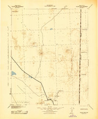
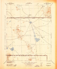
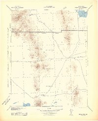
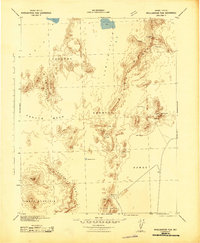
1942 Map of Tolicha Peak
USGS Topo · Published 1942About this map
Oasis Valley serves as the focal point for settlement in this high-desert region during the early 1940s. The Amargosa River draws together a collection of remote outposts, including Springdale, Indian Ranch, and the Pettus Ranch, illustrating the sparse but vital ranching and watering network of Nye County. This survey, compiled from 1905 data and updated with 1941 aerial photography, documents the landscape just as the Tonopah Bombing and Gunnery Range Military Reservation established a massive military presence to the east. The terrain is defined by prominent heights like Stonewall Mountain and Tolicha Peak, while the southwestern corner touches the boundary of Death Valley National Monument. Isolated water sources such as Monte Cristo Springs and Pillar Spring remain critical landmarks for navigation across Sarcobatus Flat and the vast Pahute Mesa.
Find a feature on this map
20 named features on this map. Tap any name to fly to it.
Don’t see what you’re looking for? This feature index may not catch every label — zoom into the map to look around manually.
Map Details
Editions of this 1942 Tolicha Peak Map
This is the sole edition of this map. No revisions or reprints were ever made.
Other maps of this area

1908 · Kawich
USGS Topo · 1:250,000

1908 · Lida
USGS Topo · 1:250,000

1908 · Furnace Creek
USGS Topo · 1:250,000

1908 · Ballarat
USGS Topo · 1:250,000

1910 · Furnace Creek
USGS Topo · 1:250,000

1913 · Lida
USGS Topo · 1:250,000

1913 · Ballarat
USGS Topo · 1:250,000
1942 · Cactus Range
USGS Topo · 1:125,000
1942 · Reveille Peak
USGS Topo · 1:125,000
1942 · Wheelbarrow Peak
USGS Topo · 1:125,000