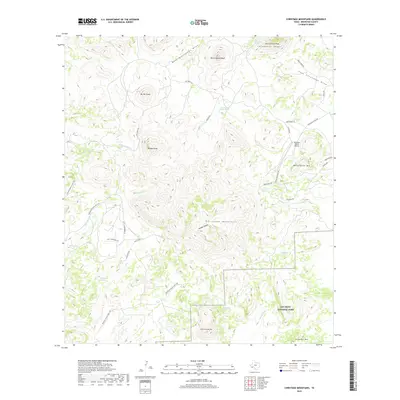
2019 Map of Christmas Mountains
USGS Topo · Published 2019About this map
The Christmas Mountains define this high-desert landscape in Brewster County, where the northern reaches of Big Bend National Park meet private ranchlands. Central to this area is Hidden Valley, a geologic basin surrounded by significant summits including Paisano Peak and Mt Williams. The network of access roads, such as Terlingua Ranch Rd and Loyd T Henderson Rd, provides insight into the modern rural development of the region, including the remote Terlingua Ranch Airport.
Find a feature on this map
42 named features on this map. Tap any name to fly to it.
Don’t see what you’re looking for? This feature index may not catch every label — zoom into the map to look around manually.
Map Details
Editions of this 2019 Christmas Mountains Map
This is the sole edition of this map. No revisions or reprints were ever made.
Other maps of this area

1903 · Chisos Mountains
USGS Topo · 1:125,000

1903 · Terlingua
USGS Topo · 1:125,000

1904 · Terlingua
USGS Topo · 1:125,000

1905 · Chisos Mountains
USGS Topo · 1:125,000

1917 · Agua Fria
USGS Topo · 1:62,500

1918 · Bone Spring
USGS Topo · 1:125,000

1918 · Nine Point Mesa
USGS Topo · 1:62,500

1937 · Nine Point Mesa
USGS Topo · 1:62,500

1937 · Agua Fria
USGS Topo · 1:62,500

1959 · Emory Peak
USGS Topo · 1:250,000