
1951 Map of Churchland
USGS Topo · Published 1951About this map
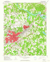
The Yadkin River defines the landscape of this 1951 survey, winding through the borderlands of Davidson, Davie, and Rowan counties. The settlement of Yadkin College sits in the northeast, while the rural communities of Churchland and Tyro anchor the southern and eastern portions of the map. Significant for family history, the area is dotted with local landmarks like Yadkin Star Ch Cem, Grubb Cem, and Sandy Creek Cem, reflecting a long-established agricultural society. Along the river's serpentine course, Horseshoe Neck and Boones Cave stand out as notable geographic features. The interior is crisscrossed by numerous small waterways, including Dutchmans Creek, Farabee Creek, and Frost Creek, which served as the lifeblood for local homesteads. Educational and religious centers like Union Chapel Sch and Crossroads Ch further illustrate the mid-century social fabric of these North Carolina townships.
Find a feature on this map
39 named features on this map. Tap any name to fly to it.
Don’t see what you’re looking for? This feature index may not catch every label — zoom into the map to look around manually.
Map Details
Editions of this 1951 Churchland Map
This is the sole edition of this map. No revisions or reprints were ever made.
Other maps of this area

1893 · Statesville
USGS Topo · 1:125,000

1950 · Lexington West
USGS Topo · 1:24,000

1950 · Churchland
USGS Topo · 1:24,000

1951 · Lexington West
USGS Topo · 1:24,000

1953 · Charlotte
USGS Topo · 1:250,000

1954 · Charlotte
USGS Topo · 1:250,000

1960 · Charlotte
USGS Topo · 1:250,000

1962 · Charlotte
USGS Topo · 1:250,000

1962 · Southmont
USGS Topo · 1:24,000
1962 · Salisbury
USGS Topo · 1:24,000