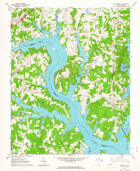
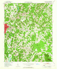
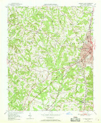
1962 Map of Southmont
USGS Topo · Published 1964About this map
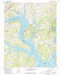
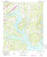
High Rock Lake dominates this landscape along the Davidson and Rowan county line, where the impounded Yadkin River creates a complex network of fingers and inlets. The drowning of old river crossings is evident near Trading Ford, a historically significant point on the river where Trading Ford Church and several small road networks converge. On the eastern shore, the Winston-Salem Southbound railway serves the community of Southmont, while the Southern railroad line skirts the northern edge of the reservoir near Linwood.
Find a feature on this map
49 named features on this map. Tap any name to fly to it.
Don’t see what you’re looking for? This feature index may not catch every label — zoom into the map to look around manually.
Map Details
Editions of this 1962 Southmont Map
3 editions found
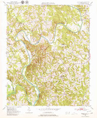
Other maps of this area
1949 · High Rock
USGS Topo · 1:24,000

1949 · Denton NW
USGS Topo · 1:24,000
1950 · Lexington East
USGS Topo · 1:24,000
1950 · Lexington West
USGS Topo · 1:24,000
1950 · Churchland
USGS Topo · 1:24,000

1951 · Churchland
USGS Topo · 1:24,000

1951 · Lexington East
USGS Topo · 1:24,000

1951 · Lexington West
USGS Topo · 1:24,000

1953 · Charlotte
USGS Topo · 1:250,000

1954 · Charlotte
USGS Topo · 1:250,000