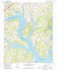
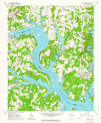
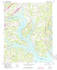
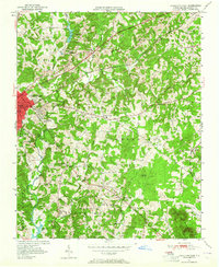
1962 Map of Southmont
USGS Topo · Published 1979About this map
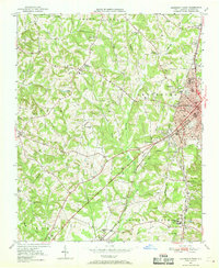
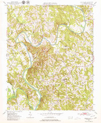
High Rock Lake dominates this mid-century landscape along the Davidson and Rowan County line, its branching inlets defined by the damming of the Yadkin River. The water levels, marked at a normal pool elevation of 624 feet, have transformed former river bottoms into a jagged shoreline of coves and points. Rural settlements like Southmont, Cotton Grove, and Linwood serve as anchors for a network of local roads including Rockcrusher Road and Holloway Church Road.
Find a feature on this map
63 named features on this map. Tap any name to fly to it.
Don’t see what you’re looking for? This feature index may not catch every label — zoom into the map to look around manually.
Map Details
Editions of this 1962 Southmont Map
3 editions found
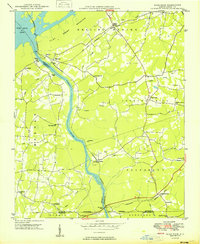
Other maps of this area
1949 · High Rock
USGS Topo · 1:24,000

1949 · Denton NW
USGS Topo · 1:24,000
1950 · Lexington East
USGS Topo · 1:24,000
1950 · Lexington West
USGS Topo · 1:24,000
1950 · Churchland
USGS Topo · 1:24,000

1951 · Churchland
USGS Topo · 1:24,000

1951 · Lexington East
USGS Topo · 1:24,000

1951 · Lexington West
USGS Topo · 1:24,000

1953 · Charlotte
USGS Topo · 1:250,000

1954 · Charlotte
USGS Topo · 1:250,000