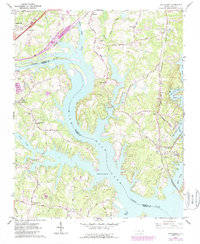
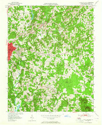
1962 Map of Southmont
USGS Topo · Published 1987About this map
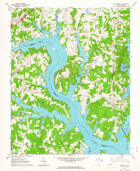
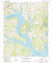
High Rock Lake dominates this 1960s landscape, its jagged shoreline and fingers of water reaching into the rural heart of Davidson and Rowan Counties. The map captures the area as the artificial reservoir, formed by the damming of the Yadkin River, defines local life and recreation. Settlement patterns follow the high ground and rail lines, with clusters of activity at Southmont and Trading Ford. Transportation is anchored by the Southern Railway and the Winston-Salem Southbound, which skirt the lake's eastern and western reaches. Genealogists will find a wealth of country churches and small burial sites, including Macedonia Ch, Providence Ch, and Bethel Cem. Significant rural landmarks like the Camp Sapona park and the Trading Ford Ch suggest the area's transition into a recreational and residential corridor along the reservoir.
Find a feature on this map
56 named features on this map. Tap any name to fly to it.
Don’t see what you’re looking for? This feature index may not catch every label — zoom into the map to look around manually.
Map Details
Editions of this 1962 Southmont Map
3 editions found
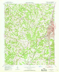
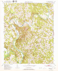
Other maps of this area
1949 · High Rock
USGS Topo · 1:24,000

1949 · Denton NW
USGS Topo · 1:24,000
1950 · Lexington East
USGS Topo · 1:24,000
1950 · Lexington West
USGS Topo · 1:24,000
1950 · Churchland
USGS Topo · 1:24,000

1951 · Churchland
USGS Topo · 1:24,000

1951 · Lexington East
USGS Topo · 1:24,000

1951 · Lexington West
USGS Topo · 1:24,000

1953 · Charlotte
USGS Topo · 1:250,000

1954 · Charlotte
USGS Topo · 1:250,000