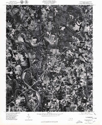
1977 Map of Churchland
USGS Topo · Published 1979About this map
The Yadkin River defines the winding character of this landscape in Davidson County, carving a dramatic serpentine path that includes the prominent bend known as the Horseshoe. This orthophotographic study, based on imagery from 1977, provides a clear view of the rural settlement patterns and agricultural development surrounding the communities of Churchland, Petersville, and Tyro. The aerial perspective reveals a dense patchwork of cleared fields and timbered tracts, illustrating the late-century transition of North Carolina's Piedmont region as local farms and residential clusters expanded near the water. Significant tributaries like Dutchman Creek and South Second Creek branch away from the main river channel, anchoring the drainage and land-use patterns of the local townships.
Find a feature on this map
7 named features on this map. Tap any name to fly to it.
Don’t see what you’re looking for? This feature index may not catch every label — zoom into the map to look around manually.
Map Details
Editions of this 1977 Churchland Map
This is the sole edition of this map. No revisions or reprints were ever made.
Other maps of this area

1893 · Statesville
USGS Topo · 1:125,000

1950 · Lexington West
USGS Topo · 1:24,000

1950 · Churchland
USGS Topo · 1:24,000

1951 · Churchland
USGS Topo · 1:24,000

1951 · Lexington West
USGS Topo · 1:24,000

1953 · Charlotte
USGS Topo · 1:250,000

1954 · Charlotte
USGS Topo · 1:250,000

1960 · Charlotte
USGS Topo · 1:250,000

1962 · Charlotte
USGS Topo · 1:250,000

1962 · Southmont
USGS Topo · 1:24,000