
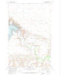
1970 Map of Circle Bridge
USGS Topo · Published 1973About this map
The Marias River carves a deep, winding valley through the northern Montana plains in this 1970 survey. The landscape is defined by its complex drainage network, with numerous deep channels including Sixmile Coulee, Wolfe Coulee, and Cottonwood Creek cutting through the high ground to reach the river below. Human presence is sparse but concentrated at key river crossings, most notably at the namesake Circle Bridge and further west at Moffat Bridge. This map offers significant detail for researchers of the Liberty County landscape, highlighting the lonely Erickson Cem situated on the higher flats away from the river bluffs. The presence of Gravel Pits near the river indicates the localized industrial use of the valley's alluvial deposits during this era.
Find a feature on this map
14 named features on this map. Tap any name to fly to it.
Don’t see what you’re looking for? This feature index may not catch every label — zoom into the map to look around manually.
Map Details
Editions of this 1970 Circle Bridge Map
This is the sole edition of this map. No revisions or reprints were ever made.
Other maps of this area

1954 · Shelby
USGS Topo · 1:250,000

1958 · Shelby
USGS Topo · 1:250,000

1970 · Poverty Coulee NE
USGS Topo · 1:24,000

1970 · Penzer School
USGS Topo · 1:24,000

1970 · Uphill Creek
USGS Topo · 1:24,000

1970 · Sagebrush Coulee
USGS Topo · 1:24,000

1970 · Poverty Coulee SE
USGS Topo · 1:24,000

1970 · Goose Bill Butte NW
USGS Topo · 1:24,000

1970 · Poverty Coulee
USGS Topo · 1:24,000
1970 · Tiber Dam
USGS Topo · 1:24,000