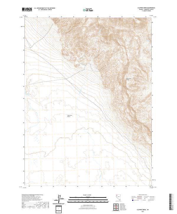
2021 Map of Clapper Creek
USGS Topo · Published 2021About this map
The Black Rock Desert dominates the southern reaches of this landscape, meeting the steep rising slopes of the Black Rock Range to the east. This transition from the flat, arid alkaline basin to the complex topography of the range illustrates the classic basin and range structure of Humboldt County. Water is a scarce and vital presence here, marked by the course of Clapper Cr and isolated points like White Rock Springs. To the west, Wheeler Reservoir sits at the edge of the desert floor, suggesting the human efforts to manage hydrology in a high-desert environment. The map captures the remote character of the region as it appeared during the 2017 to 2021 period, showing little in the way of modern infrastructure beyond survey township lines.
Find a feature on this map
11 named features on this map. Tap any name to fly to it.
Don’t see what you’re looking for? This feature index may not catch every label — zoom into the map to look around manually.
Map Details
Editions of this 2021 Clapper Creek Map
This is the sole edition of this map. No revisions or reprints were ever made.
Other maps of this area

1886 · Disaster
USGS Topo · 1:250,000

1889 · Long Valley
USGS Topo · 1:250,000

1893 · Disaster
USGS Topo · 1:250,000

1954 · Vya
USGS Topo · 1:250,000

1958 · Vya
USGS Topo · 1:250,000

1962 · Vya
USGS Topo · 1:250,000

1972 · Mud Meadow
USGS Topo · 1:24,000

1972 · Big Mountain
USGS Topo · 1:24,000
1972 · Paiute Meadows
USGS Topo · 1:24,000
1979 · Double Hot Springs
USGS Topo · 1:24,000