
1972 Map of Mud Meadow
USGS Topo · Published 1976About this map
Geothermal activity and high-desert hydrology define this 1970s survey of Humboldt County. The landscape is dotted with numerous water sources, including Spring (Hot) and several groups of Springs (Hot) that drain toward the central basin. Mud Meadow Creek feeds into the Mud Meadow Reservoir, a critical water management feature in this arid environment. The map captures a transition from the drainage flats to the steep slopes of Black Mountain and the northeastern reaches of the Black Rock Desert. Evidence of land use and resource extraction is visible through a scattered Mine near Copper Canyon and several Borrow Pits. The intricate topography of the west is carved by deep incisions such as Fly Canyon and Box Canyon, while a lonely Jeep Trail provides the primary means of traversal through the valley.
Find a feature on this map
18 named features on this map. Tap any name to fly to it.
Don’t see what you’re looking for? This feature index may not catch every label — zoom into the map to look around manually.
Map Details
Editions of this 1972 Mud Meadow Map
2 editions found
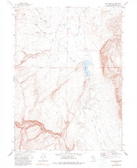
Other maps of this area

1889 · Long Valley
USGS Topo · 1:250,000

1954 · Vya
USGS Topo · 1:250,000

1958 · Vya
USGS Topo · 1:250,000

1962 · Vya
USGS Topo · 1:250,000

1972 · Soldier Meadow
USGS Topo · 1:24,000

1972 · High Rock Lake
USGS Topo · 1:24,000

1972 · Big Mountain
USGS Topo · 1:24,000
1972 · Red Mountain
USGS Topo · 1:24,000
1972 · Yellow Hills East
USGS Topo · 1:24,000
1980 · Clapper Creek
USGS Topo · 1:24,000