
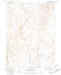
1972 Map of Soldier Meadow
USGS Topo · Published 1976About this map
Soldier Meadow Ranch stands as the primary human settlement in this high desert landscape, situated near the confluence of Soldier Meadow Creek and Mud Meadow Creek. The presence of a Landing Strip and an Historical Marker nearby suggests the area's dual role as a remote outpost and a site of recognized heritage. The terrain is defined by complex drainage systems, including the expansive Warm Springs Canyon and the evocatively named Slumgullion White Rock Creek Canyon.
Find a feature on this map
22 named features on this map. Tap any name to fly to it.
Don’t see what you’re looking for? This feature index may not catch every label — zoom into the map to look around manually.
Map Details
Editions of this 1972 Soldier Meadow Map
2 editions found
Other maps of this area

1889 · Long Valley
USGS Topo · 1:250,000

1954 · Vya
USGS Topo · 1:250,000

1958 · Vya
USGS Topo · 1:250,000

1962 · Vya
USGS Topo · 1:250,000

1965 · Rock Spring Table
USGS Topo · 1:62,500

1966 · Badger Mtn SE
USGS Topo · 1:24,000

1972 · Mud Meadow
USGS Topo · 1:24,000

1972 · High Rock Lake
USGS Topo · 1:24,000

1972 · Big Mountain
USGS Topo · 1:24,000
1972 · Red Mountain
USGS Topo · 1:24,000