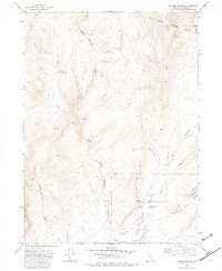
1972 Map of Soldier Meadow
USGS Topo · Published 1982About this map
Soldier Meadow Ranch anchors this high-desert landscape in Humboldt County, where geothermal activity and military history define the local geography. The presence of numerous thermal features, including Springs (Hot) and several scattered Spring points, indicates the unique hydrology of the area surrounding Warm Springs Canyon. The map records the Military Reservation Boundary and the path of the Old Military Road, tracing a legacy of frontier transit and land use. Notable terrain features like Trough Mountain and the curiously named Slumgullion rise above the drainage systems of Soldier Meadow Creek and Mud Meadow Creek. A Historical Marker located near a small Landing Strip suggests this remote location served as a significant point of reference for travelers and aviators alike in the early 1970s.
Find a feature on this map
22 named features on this map. Tap any name to fly to it.
Don’t see what you’re looking for? This feature index may not catch every label — zoom into the map to look around manually.
Map Details
Editions of this 1972 Soldier Meadow Map
2 editions found
Other maps of this area

1889 · Long Valley
USGS Topo · 1:250,000

1954 · Vya
USGS Topo · 1:250,000

1958 · Vya
USGS Topo · 1:250,000

1962 · Vya
USGS Topo · 1:250,000

1965 · Rock Spring Table
USGS Topo · 1:62,500

1966 · Badger Mtn SE
USGS Topo · 1:24,000

1972 · Mud Meadow
USGS Topo · 1:24,000

1972 · Soldier Meadow
USGS Topo · 1:24,000

1972 · High Rock Lake
USGS Topo · 1:24,000

1972 · Big Mountain
USGS Topo · 1:24,000