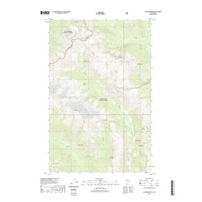
2020 Map of Clark Mountain
USGS Topo · Published 2020About this map
Mount Baker National Forest and Wenatchee National Forest converge in this high-altitude wilderness, where the Snohomish Co Chelan Co boundary traces the crest of the Cascade Range. This 2020 survey documents a landscape of extreme relief, dominated by the massif of Clark Mtn and the surrounding White Mountains. The ice-carved topography is evident in the presence of the Butterfly Glacier and Pilz Glacier, which feed high-mountain drainages including the Napeequa River and White River.
Find a feature on this map
28 named features on this map. Tap any name to fly to it.
Don’t see what you’re looking for? This feature index may not catch every label — zoom into the map to look around manually.
Map Details
Editions of this 2020 Clark Mountain Map
This is the sole edition of this map. No revisions or reprints were ever made.
Other maps of this area

1899 · Glacier Peak
USGS Topo · 1:125,000

1901 · Glacier Peak
USGS Topo · 1:125,000

1901 · Chiwaukum
USGS Topo · 1:125,000

1902 · Skykomish
USGS Topo · 1:125,000

1902 · Stehekin
USGS Topo · 1:125,000

1904 · Stehekin
USGS Topo · 1:125,000

1904 · Chiwaukum
USGS Topo · 1:125,000

1905 · Skykomish
USGS Topo · 1:125,000

1944 · Holden
USGS Topo · 1:62,500

1949 · Holden
USGS Topo · 1:62,500