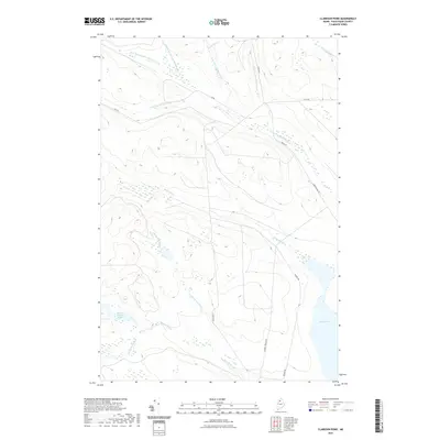
2021 Map of Clarkson Pond
USGS Topo · Published 2021About this map
Eagle Lake dominates the southeastern corner of this Piscataquis County landscape, where the waters of the Maine North Woods gather into a complex network of named tributaries. The terrain is defined by its hydrology, specifically the branching systems of Thoroughfare Brook and its western, middle, northern, and eastern forks. To the south, Russell Brook and its various branches, including N Br Russell Brook and S Br Russell Brook, feed into Lower Russell Pond and the eventual course of Russell Stream. This area is navigated primarily via a sparse network of logging and access roads such as Clarkson Rd, Poulin Rd, and Cyr Rd, indicating a landscape focused on timber management and wilderness recreation. The presence of Johns Bridge Rd and Ranger Rd near the lakeshore suggests established points of entry for those accessing the remote waterways and portages of the region.
Find a feature on this map
19 named features on this map. Tap any name to fly to it.
Don’t see what you’re looking for? This feature index may not catch every label — zoom into the map to look around manually.
Map Details
Editions of this 2021 Clarkson Pond Map
This is the sole edition of this map. No revisions or reprints were ever made.
Other maps of this area

1932 · Umsaskis Lake
USGS Topo · 1:48,000

1935 · Umsaskis Lake
USGS Topo · 1:62,500

1954 · Churchill Lake
USGS Topo · 1:62,500

1954 · Allagash Lake
USGS Topo · 1:62,500

1954 · Presque Isle
USGS Topo · 1:250,000

1955 · Clayton Lake
USGS Topo · 1:62,500

1958 · Presque Isle
USGS Topo · 1:250,000

1960 · Presque Isle
USGS Topo · 1:250,000

1961 · Allagash Lake
USGS Topo · 1:62,500
1962 · Churchill Lake
USGS Topo · 1:62,500