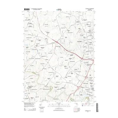
2014 Map of Clarksville
USGS Topo · Published 2014About this map
The Middle Patuxent River and its various tributaries, including Carrolls Br and Hammond Br, define the drainage and development patterns of this portion of Howard and Montgomery Counties. In this 2014 representation, the suburban expansion of the Columbia corridor is evident, yet the landscape remains dotted with historical markers such as the Linthicum Cem and Saint Marks Cem. The northwestern portion of the map shows a more rural character near Dayton and Twelve Hills, while the western edge is bounded by the significant waters of the Triadelphia Reservoir. This document serves as a detailed record of modern land use, capturing the transition from agricultural tracts like Allnutt Farms Estates to dense residential subdivisions and institutional campuses like the Howard Community Coll.
Find a feature on this map
288 named features on this map. Tap any name to fly to it.
Don’t see what you’re looking for? This feature index may not catch every label — zoom into the map to look around manually.
Map Details
Editions of this 2014 Clarksville Map
This is the sole edition of this map. No revisions or reprints were ever made.
Other maps of this area

1892 · Laurel
USGS Topo · 1:62,500

1892 · Ellicott
USGS Topo · 1:62,500

1893 · Frederick
USGS Topo · 1:125,000

1894 · Ellicott
USGS Topo · 1:62,500

1894 · Laurel
USGS Topo · 1:62,500

1894 · Frederick
USGS Topo · 1:125,000

1897 · Laurel
USGS Topo · 1:62,500

1906 · Ellicott
USGS Topo · 1:62,500

1907 · Laurel
USGS Topo · 1:62,500

1908 · Patapsco
USGS Topo · 1:125,000