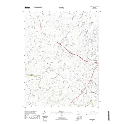
2019 Map of Clarksville
USGS Topo · Published 2019About this map
Clarksville and the surrounding rural suburbs of Howard County are documented here as they appeared in 2019, reflecting a landscape where agricultural roots meet modern residential growth. The Middle Patuxent River and its tributaries, such as Skunk Cabbage Cr and Hammond Br, define the local drainage patterns and provide a backdrop for many established communities like Dayton, Highland, and Fulton. This period of the area's history is notable for the preservation of legacy sites amid suburban development, including several family-named landmarks like the Roberts / Burkett / Dorsey / Hall Family Cem.
Find a feature on this map
215 named features on this map. Tap any name to fly to it.
Don’t see what you’re looking for? This feature index may not catch every label — zoom into the map to look around manually.
Map Details
Editions of this 2019 Clarksville Map
This is the sole edition of this map. No revisions or reprints were ever made.
Other maps of this area

1892 · Laurel
USGS Topo · 1:62,500

1892 · Ellicott
USGS Topo · 1:62,500

1893 · Frederick
USGS Topo · 1:125,000

1894 · Ellicott
USGS Topo · 1:62,500

1894 · Laurel
USGS Topo · 1:62,500

1894 · Frederick
USGS Topo · 1:125,000

1897 · Laurel
USGS Topo · 1:62,500

1906 · Ellicott
USGS Topo · 1:62,500

1907 · Laurel
USGS Topo · 1:62,500

1908 · Patapsco
USGS Topo · 1:125,000