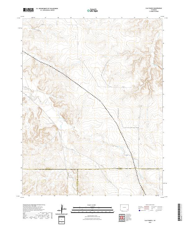
2022 Map of Clay Ranch
USGS Topo · Published 2022About this map
The High Plains of southeastern Colorado meet at a unique triple-county boundary on this survey, where Bent, Baca, and Las Animas counties converge. The landscape is defined by the dendritic drainage patterns of Rule Cr and Cottonwood Cr, which carve through the arid terrain. This 2022 dataset reveals a remote cattle-ranching environment dominated by Section-line roads and large-scale land divisions, such as those within Township 27 South, Range 50 West.
Find a feature on this map
26 named features on this map. Tap any name to fly to it.
Don’t see what you’re looking for? This feature index may not catch every label — zoom into the map to look around manually.
Map Details
Editions of this 2022 Clay Ranch Map
This is the sole edition of this map. No revisions or reprints were ever made.
Other maps of this area

1891 · Higbee
USGS Topo · 1:125,000

1892 · Two Butte
USGS Topo · 1:125,000

1893 · Higbee
USGS Topo · 1:125,000

1893 · Two Butte
USGS Topo · 1:125,000

1955 · La Junta
USGS Topo · 1:250,000

1958 · La Junta
USGS Topo · 1:250,000

1966 · Toonerville SE
USGS Topo · 1:24,000
1966 · Toonerville
USGS Topo · 1:24,000

1967 · Hand Springs
USGS Topo · 1:24,000

1968 · La Junta
USGS Topo · 1:250,000