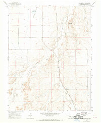
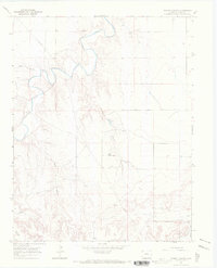
1966 Map of Toonerville
USGS Topo · Published 1969About this map
Atchison Topeka and Santa Fe railroad tracks anchor the eastern corridor of this Bent County landscape, connecting the small settlements of Toonerville and Ruxton in the late 1960s. The topography is defined by the transition from the level Heinan Flats in the northwest to the more complex drainage systems of Rule Creek and Muddy Creek. These waterways, accompanied by infrastructure like the Rock Ditch and County Canal, highlight the critical role of water management in this arid Colorado region. Small-scale landmarks, such as the McAfee Windmill and the high point at Eagle Nest, provide specific points of interest for genealogists and local historians tracking rural land use. The map also identifies the locality of Nena, situated along the rail line, offering a precise view of the regional transportation and settlement patterns before further modernization.
Find a feature on this map
14 named features on this map. Tap any name to fly to it.
Don’t see what you’re looking for? This feature index may not catch every label — zoom into the map to look around manually.
Map Details
Editions of this 1966 Toonerville Map
This is the sole edition of this map. No revisions or reprints were ever made.
Other maps of this area

1891 · Higbee
USGS Topo · 1:125,000

1893 · Higbee
USGS Topo · 1:125,000

1955 · La Junta
USGS Topo · 1:250,000

1958 · La Junta
USGS Topo · 1:250,000

1966 · Toonerville SE
USGS Topo · 1:24,000
1966 · Gilpin
USGS Topo · 1:24,000
1966 · Toonerville NE
USGS Topo · 1:24,000
1966 · Hackamore Ranch
USGS Topo · 1:24,000
1966 · Turkey Canyon
USGS Topo · 1:24,000

1968 · La Junta
USGS Topo · 1:250,000