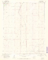
1966 Map of Gilpin
USGS Topo · Published 1969About this map
The Purgatoire River cuts across the northwest corner of this 1960s landscape, bordering the Picketwire Valley. The central terrain is defined by the Atchison Topeka and Santa Fe railroad, which runs north-to-south through the region, passing the small settlement of Gilpin. This rail corridor serves as a primary axis for the area's movement and development, flanked by notable topographic features like Ninemile Hill and Getchel Hill.
Find a feature on this map
14 named features on this map. Tap any name to fly to it.
Don’t see what you’re looking for? This feature index may not catch every label — zoom into the map to look around manually.
Map Details
Editions of this 1966 Gilpin Map
2 editions found
Other maps of this area

1891 · Higbee
USGS Topo · 1:125,000

1891 · Las Animas
USGS Topo · 1:125,000

1893 · Higbee
USGS Topo · 1:125,000

1893 · Las Animas
USGS Topo · 1:125,000

1953 · Las Animas
USGS Topo · 1:24,000

1953 · Cornelia
USGS Topo · 1:24,000

1953 · Kreybill
USGS Topo · 1:24,000

1954 · Lamar
USGS Topo · 1:250,000

1955 · La Junta
USGS Topo · 1:250,000

1958 · La Junta
USGS Topo · 1:250,000