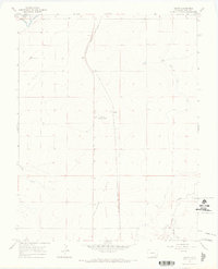
1966 Map of Gilpin
USGS Topo · Published 1969About this map
The Purgatoire River winds through the northwestern corner of this territory, shaping the lowlands of Picketwire Valley before the terrain rises into the High Plains. Central to the local landscape is the Atchison Topeka and Santa Fe railroad, which follows the natural contours of the land through the small settlement of Gilpin. This rail line served as a vital transport artery for the ranching and agricultural interests scattered across the wide expanses of Heinan Flats.
Find a feature on this map
12 named features on this map. Tap any name to fly to it.
Don’t see what you’re looking for? This feature index may not catch every label — zoom into the map to look around manually.
Map Details
Editions of this 1966 Gilpin Map
2 editions found
Other maps of this area

1891 · Higbee
USGS Topo · 1:125,000

1891 · Las Animas
USGS Topo · 1:125,000

1893 · Higbee
USGS Topo · 1:125,000

1893 · Las Animas
USGS Topo · 1:125,000

1953 · Las Animas
USGS Topo · 1:24,000

1953 · Cornelia
USGS Topo · 1:24,000

1953 · Kreybill
USGS Topo · 1:24,000

1954 · Lamar
USGS Topo · 1:250,000

1955 · La Junta
USGS Topo · 1:250,000

1958 · La Junta
USGS Topo · 1:250,000