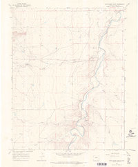
1966 Map of Hackamore Ranch
USGS Topo · Published 1970About this map
The Purgatoire River carves a deep path through this landscape in Bent County, marked by the winding curves of its canyon and the presence of the Highland Canal. This 1960s survey documents a region defined by its water management and ranching infrastructure, where the Picketwire River joins the larger drainage system. The Hackamore Ranch serves as a primary landmark in a territory dissected by numerous drainages like Arroyo Tarbox, Rock Arroyo, and Smith Draw. For researchers, the map provides precise locations for agricultural and industrial features, including the J J Windmill, Farrington Spring, and several Gravel Pit operations. The intricate topography of Mixon Canyon and Farrington Draw highlights the complex erosional patterns of the Colorado high plains during this era.
Find a feature on this map
13 named features on this map. Tap any name to fly to it.
Don’t see what you’re looking for? This feature index may not catch every label — zoom into the map to look around manually.
Map Details
Editions of this 1966 Hackamore Ranch Map
This is the sole edition of this map. No revisions or reprints were ever made.
Other maps of this area

1891 · Higbee
USGS Topo · 1:125,000

1891 · Las Animas
USGS Topo · 1:125,000

1893 · Higbee
USGS Topo · 1:125,000

1893 · Las Animas
USGS Topo · 1:125,000

1953 · Las Animas
USGS Topo · 1:24,000

1953 · Cornelia
USGS Topo · 1:24,000

1953 · Hadley
USGS Topo · 1:24,000

1954 · Lamar
USGS Topo · 1:250,000

1955 · La Junta
USGS Topo · 1:250,000

1958 · La Junta
USGS Topo · 1:250,000